


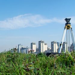
Projects (Geospatial & Survey) | Research | Consultants | NGOs | CSR |
Electrical Resistivity Survey and Subsurface Mapping | Glaciology Mapping & Glacier Monitoring using Remote Sensing & GIS | Human Resource (HR) Consultancy | NGO Project Planning & Proposal Writing | CSR Program Planning & Implementation |
Groundwater Exploration & Hydrogeological Investigation | Groundwater Potential Zone Mapping using Geospatial Techniques | Corporate Recruitment Services | Rural Development & Community Infrastructure Mapping | Training & Capacity Building Programs |
Urban Planning & Spatial Development Analysis using GIS | Environmental & Natural Resource Management Studies | Campus Placement Drives | Monitoring, Evaluation & Impact Assessment (M&E) | Community Development Support |
Drone-Based Survey, Mapping & 3D Terrain Modelling | Research, Documentation & Report Preparation | Professional Job Placement Services | Baseline Survey & Socio-Economic Studies | CSR Impact Assessment |
Remote Sensing & GIS-Based Spatial Data Analysis | Agriculture Resource Mapping & Crop Monitoring using GIS | Career Counselling & Skill Guidance | *Development Project Monitoring *Child Education & Skill Development Programs | CSR Project Monitoring |
Cadastral Mapping | Mining Area Mapping & Mineral Exploration using GIS & Remote Sensing | Business Development & Promotion Support | Old-Age Home Support & Senior Citizen Welfare Programs | Integrated Village Development Programs |
🔹 The Cartographer – Complete Mining Auction Support & Advisory At The Cartographer, we provide end-to-end strategic, technical, and regulatory support for Granite & Quartz mineral block participation. | ||
Our Core Services: | ||
1–Technical & Geospatial Due Diligence | 2–Land & Area Evaluation | 3–Application & Documentation Support |
4–Statutory Liaisoning & Approvals | 5–Strategic Advisory |
Connect with us for professional guidance and structured mining investment support. |
Dr. Kutubuddin Beg has good academics records and have excellent knowledge in the field of Geology, Hydrology, Remote Sensing, GIS, Watershed Development and Management, Natural Resource Development and Management and Digital Image Processing. He has very good command in GIS Software and Skill to interpretation and classification of Very High Resolution [VHR] Satellite Images.
Dr. Beg has total 16+ year of experience since 2005. He is currently Life Member of Indian Society of Remote Sensing (ISRS), Mahakoshal vigyan Parishad and Membership of Geological survey of India. Dr. Beg has published many Research Papers in National and International Journals and participated. Besides of Research Publications, he has completed many ISRO Sponsored and DST Sponsored Projects.
Mr. Ram Moorat Singh [M.Sc. Applied Geology] has good academic records and have excellent knowledge in the field of Glaciology, Geology, Hydrology, Remote Sensing and GIS.
He Worked in prestigious institutions like National Institute of Technology [NIT], Raipur and Wadia Institute of Himalayam Geology [WIHG], as a Researcher. Mr.Singh has published many research papers in National and International Journal. He has very good command in GIS Software and have good knowledge of Arc-GIS, Q-GIS and Environment for Visualizing Images [ENVI], ERDAS Imagine and COSI-CORR Software. Mr. Singh has total 5+ year of experience since January 2016. He is currently Life Member of Indian Society of Remote Sensing [IRSR_L-4681], Indian Society of Geomatics [ISG], Indian Polar Research Network [IPRN], APECS India and Vigyan Bharti Life Membership. Besides of Research Publications, he has completed many ISRO Sponsored and DST Sponsored Projects.
Mr. Singh Awarded as Best Paper Presentation Award [Student Category] of 2016 by Indian Institute of Remote Sensing [IIRS], Indian Space Research Organisation [ISRO].
Mr. Anurag Singh bring with him more than 6 years of experience in GIS Domain /GIS Technology, has excellent analytics. Prior to coming on board he was associated with many reputed agencies [Map-IT], MPCOST, Department of Town Planning and Country Planning, Department of Panchyati Raj Government of Uttar Pradesh. He held Master Degree in Earth Science and Post Graduate Diploma in RS and GIS.
Mr Ankit Gupta is a Research Scholar expertise in the field of GIS and Geophysical based technique to Groundwater exploration. He has a good academic record and qualified National level exam like GATE and CSIR-NET with high rank. He also worked with varied prestigious institute like CSIR -NGRI (National Geophysical Research Institute), Space Application Center (SAC-Ahmadabad) and State IT Center (Map IT) Bhopal.